Close-proximity visual inspection of assets that are dangerous, expensive, or simply impractical to reach by ladder, lift, or rope.
What we inspect
Every inspection is flown to a defined scope, so you receive exactly the coverage you commissioned — documented, organized, and repeatable on the next cycle.
Close-proximity, AI-navigated inspection in GPS-denied environments — including underneath bridge decks and inside tight corridors where conventional drones fail.
Vertical assets documented without climbing crews or shutdowns. Repeatable flight paths mean each inspection cycle is directly comparable to the last.
Full roof documentation for insurers, adjusters, property managers, and contractors — every slope, penetration, and problem area on record.
From the field
Municipal water tower and co-located cellular equipment, documented from above. No climb crew, no rigging, no tower shutdown — and full coverage of a work platform that is difficult and hazardous to photograph by hand.
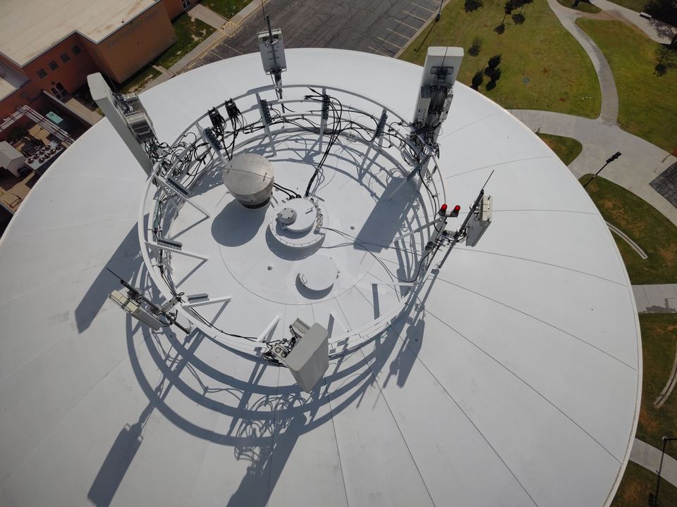
OVERHEAD — FULL PLATFORM, CABLE RUNS & MOUNTS
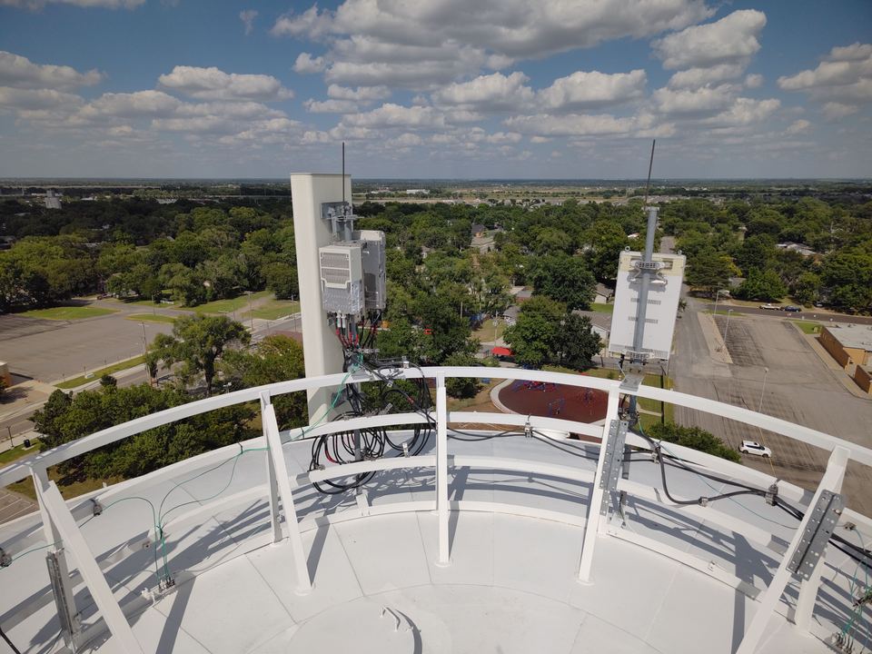
CLOSE APPROACH — ANTENNA, RADIO & CONNECTIONS
Why aerial
The single largest safety exposure in inspection work is putting a person on a ladder, lift, or rope. Aerial capture removes it entirely.
Most assets are captured in a single visit with operations running normally — no crane, no scaffolding, no production downtime.
A flown inspection documents the entire asset, not just the accessible portions — so findings are defensible and gaps are obvious.
Dated, organized imagery becomes evidence — for claims, for warranty disputes, and for demonstrating condition over time.
Send the location, what you need captured, and any deadline. You'll get a flat quote and the first available flight window.